
![]()


![]()

Well No. NC-EWDP-2DB SITE SUMMARY
Status: Completed. Borehole drilled to a depth of 3,075 feet. Casing installed to 2,685 feet.
Latitude/Longitude (Datum NAD-83):
36o 39' 39.344" North
116o 27' 57.755" West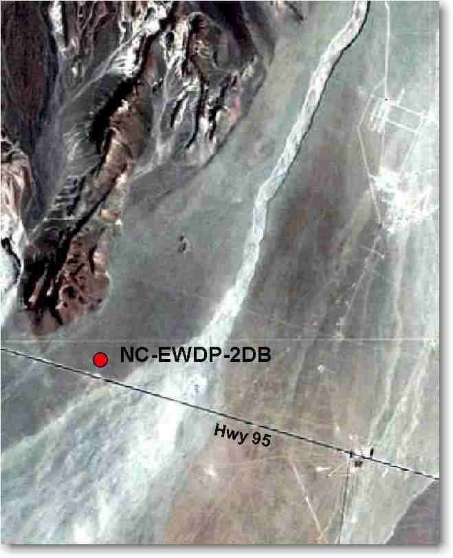
Legal Description:
Township 15S Range 49E
Section 9 NE 1/4 SW 1/4Elevation (Datum NGVD-29):
801.29 meters AMSL (2,628.90 feet) GPSAccess: Take Highway 95 north from the Lathrop Wells Junction 4.1 miles to the gate on the north side of the highway. Take the gravel road 0.1 miles east.
Purpose: ) provide lithologic samples; 2) define the valley-fill stratigraphic sequence; and 3) determine depth, nature and characteristics of the carbonate aquifer.
NC-EWDP-2DB is located along a key groundwater pathway between Yucca Mountain and the Amargosa Desert. This site was selected to define the number and types of aquifers present in the Fortymile Wash Area down-gradient of Yucca Mountain. The well NC-EWDP-2D had been drilled to 1,618 feet in fiscal year 1999 and NC-EWDP-2DB was drilled at the same site to explore the Paleozoic Carbonate Aquifer in fiscal year 2000.
