


Well No. NC-EWDP-3DB SITE SUMMARY
Status: Complete.
Latitude/Longitude (Datum NAD-83):
36o 40' 52.601" North
116o 32' 17.216" WestLegal Description:
Township 15S Range 48E
Section 2 SW 1/4 SW 1/4 1/4Elevation (Datum NGVD-29):
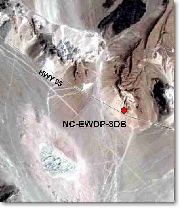
796.61 meters AMSL (2,613.56 feet) GPSAccess: Take Highway 95 north from the Lathrop Wells Jct. 7.5 miles to the gate on the north side of the highway. Take the gravel road 0.15 miles north; turn east and follow tire tracks.
Purpose: 1) provide lithologic samples; 2) define valley-fill stratigraphic sequence and groundwater flow paths down-gradient of the proposed repository; and 3) provide water level and water chemistry data.
